Dr. V.K.Maheshwari, M.A. (Socio, Phil) B.Sc. M. Ed, Ph.D. Former Principal, K.L.D.A.V.(P.G) College, Roorkee, India
Mrs Sudha Rani Maheshwari, M.Sc (Zoology), B.Ed. Former Principal. A.K.P.I.College, Roorkee, India
__________________________________________________________________
A component in the workplace environment that can cause injury,illness,or death. The damage to the environment is caused both by natural (Non Anthropogenic) and manmade (Anthropogenic) reasons. The natural impacts are non-preventable and on many occasions unpredictable. However knowledge of natural hazards is essential in order to take mitigated actions
so that loss of life and property can be minimized. On the other hand Anthropogenic detrimental impacts on environment are eminently preventable but only with a focused global effort.
Earthquakes
 An earthquake is the sudden, rapid shaking of the earth, caused by the braking and shifting of subterranean rock as it releases strain that has accumulated over a long time. Earthquakes occur as the result of the release of pressure along a fault in the tectonic plate boundaries but can occur anywhere. Earthquakes last only few seconds but they cause extensive damage to buildings, gas and water pipes, power and communication lines, and roadways. They can also serve as triggers for several other natural hazards. In fact, the primary cause of damage in recent earthquakes is fire from damaged gas pipes and power lines. Slope failures are triggered by the energy release associated with earthquakes. When earthquakes occur in an ocean or large lake, a tsunami may form and flood surrounding coastlines. Earthquakes often occur along with volcanic activity, which results in a variety of additional threats.
Earthquakes simply demonstrate that the earth is consistently a changing system. They general depict a built up stress in the lithosphere which occurs along its, planar breaks in rock where there is displacement of the side relative to the other. When the stress at last exceeds the rupture strength of the rock a sudden movement occurs to release the stress. This experience may be simply described as earthquake or seismic slip.
The magnitude of most earthquakes is measured on the Richter scale, invented by Charles F. Richter in 1934. The Richter magnitude is calculated from the amplitude of the largest seismic wave recorded for the earthquake, no matter what type of wave was the strongest.
The Richter magnitudes are based on a logarithmic scale (base 10). What this means is that for each whole number you go up on the Richter scale, the amplitude of the ground motion recorded by a seismograph goes up ten times. Using this scale, a magnitude 5 earthquake would result in ten times the level of ground shaking as a magnitude 4 earthquake (and 32 times as much energy would be released). To give you an idea how these numbers can add up, think of it in terms of the energy released by explosives: a magnitude 1 seismic wave releases as much energy as blowing up 6 ounces of TNT. A magnitude 8 earthquake releases as much energy as detonating 6 million tons of TNT.
Landslide can be a serious secondary earthquake hazard in hilly areas. Earthquakes are one of the major events that trigger slides on unstable slopes. The best solution is not to build in such areas.
Volcanic Eruptions
 Volcanoes are vents in the earth’s surface through which magma, gases, and other materials are discharged from the core. They are found primarily at tectonic plate boundaries. They also exist at hot spots, which are places in the earth’s crust where hot mantle plumes have broken through. Some volcanoes erupt explosively, while others erupt slowly. Explosive volcanoes present many potential threats including the release of toxic gases, flows containing fragments of hot rock and ash, fast moving clouds of extremely hot gases and fine ash and large volumes of ash. It is common for volcanoes to trigger other natural hazards like debris flows, earthquakes, floods, landslides and fires. Volcano and earthquake risk maps overlap considerably.
~lahar /ˈlɑːhɑr/ is a type of mudflow or debris flow composed of a slurry of pyroclastic material, rocky debris, and water. Lahars are extremely destructive: they can flow tens of meters per second, be 140 meters (460 ft) deep, and destroy any structures in their path1 Description
Lahars have the consistency, viscosity and approximate density of concrete: fluid when moving, solid at rest. Lahars can be huge. A lahar of sufficient size and intensity can erase virtually any structure in its path, and is capable of carving its own pathway, making the prediction of its course difficult. A lahar’s viscosity decreases with time, and can be further thinned by rain, but it nevertheless solidifies quickly when coming to a stop.
Lahars vary in size and speed. Small lahars less than a few meters wide and several centimeters deep may flow a few meters per second. Large lahars hundreds of meters wide and tens of meters deep can flow several tens of meters per second: much too fast for people to outrun.[3] With the potential to flow at speeds up to 100 kilometers per hour (60 mph), and flow distances of more than 300 kilometres (190 mi), a lahar can cause catastrophic destruction in its path.
With regards to environmental control there is no known method of preventing volcanic eruption. Similarly, there is no known defense against the pyroclastic flows and comparatively little can be done to protect standing crops and exposed water supplies from air-fall tephra. Therefore, lava flows moving at comparatively slow speeds are the volcanic hazard over which most physical control can be exerted.
Three possible methods of diverting and controlling lava flows are, bombing , artificial Barriers and water Sprays
Floods
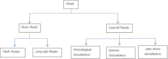
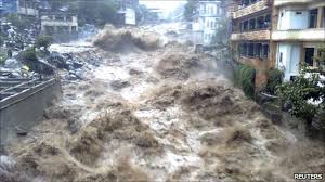 Floods are high water levels above the banks of a stream channel, lakeshore, or ocean coast that submerge areas of land usually not submerged. They are natural, reoccurring events in every stream, lake, and coastal environment. A flood can be caused by unusually intense or prolonged precipitation, storms, dam collapses, etc. Since most of the world’s population lives on or near coasts and plains, floods are a threat to hundreds of millions of people. Floods can cause loss of life, extensive damage to property, contamination of drinking water, and destruction of crops and fields. They can also help produce rich soils for agriculture, which encourages people to live in floodplains. Floods occur in arid and wet environments, highlands and lowlands, and in both populated and unpopulated regions. They are less common in dry environments and highlands. Floods occur in many temperate regions around the world. However, floods can occur at any time of the year, depending on location. The timing of floods is largely dependent on climate and seasonal weather patterns. In India, floods are a common feature during monsoons.
Flood is referred to as a relatively high flow that over-tops the natural or artificial boundary of a water body. It is also regarded as an over flow or inundation that comes from a river or other body of water and causes or threatens damage or simple as a deluge or inundation . Flood can also be defined as the highest values of the stage or discharge of a stream during the water year.
There are numerous factors which may influence floods in any stream. These are divided under three broad categories:
• Climatic factors such as precipitation,
• Interception and physical factors; and
• Channel characteristics, including types and efficiency.
Of all environmental hazards, none is more paradoxical than floods. Simply because it is the most frequently occurring natural hazard that causes the greatest damage as well as the most beneficial effect.
Cyclones, Hurricanes and Tornadoes
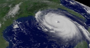 Tropical cyclones are greatly intensified low-pressure areas that spend most of their lives over the oceans. In the Atlantic Ocean, they are called hurricanes. In the Pacific Ocean, they are usually referred to as typhoons. Warm temperatures and moisture drive them. When a hurricane moves over land or cool water, it loses strength. Tropical storms become hurricanes once their winds exceed 74 mph (119 km h). In a hurricane, building doors and windows are frequently broken by debris picked up in the hurricane’s strong and sustained winds. These winds can rip roofs from buildings, topple trees, and damage power and communication lines. In some cases, hurricanes can produce tornado-like vortices (called “mini-swirls”), which can completely destroy buildings. Coastal flooding is a major threat in hurricanes, due to the combination of storm surges and torrential rain.
Storm surges are rises in ocean levels produced by the effects of high wind and low atmospheric pressure. Storm surges also increases coastal erosion, potentially resulting in slope failures. Hurricanes can even start fires by damaging power lines. Contamination of drinking water and disruption of utility services (such as electricity, communications, and sewer) are common occurrences during a hurricane.
Hurricanes are greatly intensified low-pressure cells born over the tropical oceans. They require vast amounts of warm, moist air to survive. Hurricanes lose strength over land or Cool Ocean water.
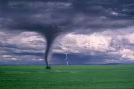 Tornadoes are fast rotating columns of air associated with severe thunderstorms. A thunderstorm can produce many tornadoes, and a tornado can have more than one vortex. Wind speeds as much as 450 km h are possible. These high winds can quickly destroy entire buildings and in some cases, entire communities. The debris carried by such high winds causes severe injury or death to people and other life. Hail is commonly associated with thunderstorms and is also capable of causing extensive damage in a very short time. Tornadoes move along the surface at up to 70 mph (113 km h) and remain on the ground for several minutes. Most tornadoes occur between the 4:00 P.M. and 6:00 P.M., when the lower atmosphere is most unstable. Many tornadoes also occur after sunset—these tornadoes can be very dangerous because they are difficult to see and people are less easily alerted.
Tsunamis
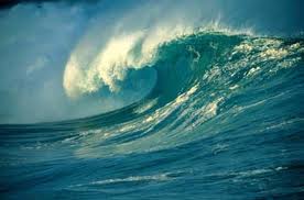 Seismic ocean waves are now commonly referred to as tsunamis (Japanese for “harbor waves”). A tsunami is traditionally defined as a series of ocean waves with very long wavelengths that can travel great distances. Tsunamis can also occur in large lakes. In deep oceans, tsunamis can reach speeds over 800 kph. Tsunami wave heights near a shore average 9 meters, but have been recorded over 30 meters. They can carry large ocean vessels inland, inundate coasts, and drag entire communities out to sea as they recede. Tsunamis can be generated by any event that displaces a large volume of ocean water, such as an earthquake, volcanic eruption or landslide. Tsunamis threaten coasts throughout the Pacific Ocean, which has frequent earthquakes. Although they are rare, Tsunamis do occur in the Atlantic Ocean, Mediterranean Sea, and large lakes.
Snow and Ice
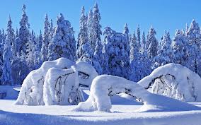 Snow and ice are well known hazards to those living in mountainous areas or regions north of about 35 degrees N latitude. Prolonged power failures, automobile accidents, transportation delays, damage to buildings, and dangerous walkways are often attributed to snow and ice during the winter months. Slippery surfaces and reduced visibility are responsible for many accidents.
Snow can be warm, causing wet and slushy conditions, or cold, creating dry and powdery conditions. The latter leads to blizzards and drifting when mixed with high winds. Blizzards can quickly reduce visibility to zero. Drifting can block roadways, airport runways, and even bury buildings. Both are often associated with low wind chills, which are dangerous to exposed skin, especially when wet from snow. In many mountainous regions, avalanches are a common hazard.
When large masses of mountain snow begin to melt in the spring, floods often become an imminent hazard to people living in valleys. The total amount of snow received at any location is dependent on temperature, atmospheric pressure, topography and proximity to moisture sources.
The snow avalanches are a special type of mass movement. They are common features of mountainous terrain throughout arctic and temperate regions wherever snow is deposited on slopes .
Finally we stressed that it is common to recognize three types of avalanche motion they are;
• Power avalanches are the most hazardous are formed of an aerosol of fine , diffused snow behaving like a body of dense gas.
• Dry flowing avalanches are formed of dry snow travelling over steep or irregular terrain with particles ranging in size from power grains to blocks of up to 0.2 m diameter.
• Wet-flower, avalanches occur mainly in the spring season and are compose d wet snow formed either of rounded particles (from 0.1 m to several meters in diameter) or a mass of sludge.
Thunderstorms
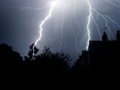 Thunderstorms are relatively small, organized parcels of warm and moist air that rise and produce lightning and thunder. They are one of nature’s ways of balancing the amount of energy in the atmosphere—it is estimated that over 40,000 thunderstorms occur each day around the world. Although most last only 30 minutes, thunderstorms can create several dangerous phenomena:
- Torrential rain produced by thunderstorms is usually intense, but short in duration— flash flooding is often associated with this type of precipitation. In fact, flooding is the greatest threat from thunderstorms; also, slope failures can be triggered by the intense precipitation from thunderstorms in areas with steep, unstable hillsides.
- High wind: Inside a thunderstorm, air rises and descends rapidly, transferring vast amounts of energy. Such movement is dangerous for airplanes. Winds at the surface beneath a thunderstorm can reach well over 80 kph.
- Hail falling at speeds of several meters per second can result in extensive damage to crops and property in just a few minutes and can injure or kill people and other organisms
- Lightning frequently starts fires, which threaten homes, businesses, and lives. Power and communication failures caused by lightning (as well as wind) can result in large scale disruption of everyday activities. down slope movement of
Land Slide
 The large volumes of surface materials under gravitational influences are an important environmental hazard, common in mountainous terrain. Rapid movements cause most loss of the life and damage; including human-induced land subsidence, have less potential to kill but can be costly. Depending on the dormant material, these movements tend to be grouped into landslides (rock and soil) or avalanches (snow and ice).
Types of landslide
There are two main types of landslide:
• Rotational slides
• Translational slides
Causes of landslides are;
• An increase in slope angle
• Removal of lateral support at the foot of a slope.
• Additional weight placed on the slope by the dumping of waste or house construction.
• Removal of vegetation by wildfires or through human activities such as logging, overgrazing or construction.
• Local shocks and vibrations
Droughts
 A drought is an extended period of depleted soil water. Drought occurs when more water is taken out of an area than is added to it. This is often the result of a combination of persisting high pressure over a region, which produces clear skies with little or no precipitation, and excessive use of water for human activities. Droughts can result in decreased crop yields, decreased drinking water quality and availability and food shortages. Thus, as population increases and the demand for food and water increases the probability of drought increases and the implications of drought become more and more serious. Also, when vegetation becomes dry during a drought, fire risk increases, threatening homes, crops, and lives. The greatest threat from drought occurs when agricultural regions receive very low rainfall, leading to plant desiccation. When this happens, crop yields decrease resulting in increased food prices, food shortages, and even famine.
Most agricultural crops are grown in the semi-arid and humid regions of the world. Water shortages in either of these regions can pose an immediate threat to agricultural productivity. With global climate change, droughts are expected to become a major problem for several agricultural regions. In semi-arid and arid regions, droughts commonly result in deteriorating drinking water quality and availability. Besides the immediate impacts associated with water shortages and poor water quality, delayed impacts (such as susceptibility to disease) are major problems in several less-developed regions of the world.
Drought has been described as an extended and continuous duration of very dry weather. This definition varies from country to country, since weather varies.
There are three types of drought are recognized:
(a) total drought is a period of 15 or more consecutive days with a rainfall below 0.2mm;
(b) partial drought has a duration of 29 successive days with an a mean rainfall of 0.2 mm or less per day;
(c) a dry spell has a duration of 15 or more successive days, dur ing which the rainfall does not exceed 1 mm per day.
Some of the features of drought were articulated as:
(a) Low rainfall and high rainfall variability.
(b) High evaporation and potential evapotranspiration rates
(c) Generally persistent negative rainfall anomalies
(d) Occasional torrential rains resulting in floods
(e) Rapidly high erosive runoff especially on steep terrains
(f) Sparse vegetation cover
(g) Too little moisture for rain fed cultivation throughout
El Nino and La Nina
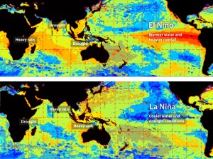 El Nino and La Nina are triggers for many natural hazards because they produce unusual weather throughout the world. The Earth’s oceans and atmosphere are closely connected and hence a change in one produces an immediate or delayed change in the other. El Nino involves the warming of sea surface temperatures in the equatorial Pacific Ocean. This temperature change at the ocean’s surface causes the usual positions of the jet streams and pressure cells to shift.
This causes changes in the global weather patterns produces floods , droughts and other hazards, leading to thousands of deaths and property damages. A La Nina event usually occurs the year after the end of an El Nino event and involves abnormal cooling of the same ocean waters. This can also cause changes in atmospheric circulation, thereby altering weather patterns for many locations around the world.
Because El Nino and La Nina produce considerable changes in atmospheric circulation, the effects are noticeable globally. However, certain locations feel the effects of El Nino and La Nina more than others due to a variety of factors. El Nino events usually begin between January and March and peak during the month of December. Not every El Nino event is followed by a La Nina event. When it happens, the effects of La Nina are usually most noticeable between the months of December and January.
Fog
 Fog is a cloud near the ground. A cloud is an area of condensed water droplets (or ice crystals in the upper atmosphere). The processes that produce clouds high above the ground also produce clouds near the surface. Fog forms when air is unable to hold all of the moisture
it contains. This happens when air is cooled to its dew point, or the amount of moisture in the air increases. Once air reaches its dew point, water vapor condenses onto very small particles forming tiny water droplets that comprise fog. Fog is a hazard because of reduction in visibility.
Airport delays, automobile accidents, shipwrecks, plane crashes, and many other transportation problems are frequently caused by fog. When air pollution (such as smoke) combines with fog, visibility decreases even more. Acid fog, resulting from the combination of air pollutants (such as nitrogen and sulfur oxides) with water droplets can create health problems, for people with respiratory problems. Fog can also be beneficial. Several species of plants depend on fog for moisture.
Fog can occur during any season and almost anywhere in the world. The following are common types of fog:
• Advection Fog: When warm, moist air is blown over a cold surface, the surface
can lower the temperature of the air to its dew point.
• Evaporation Fog: Water evaporates from the surface of streams, lakes, and oceans
and accumulates near the earth surface.
• Radiation (or Ground) Fog: Common on clear nights with little or no wind, this
type of fog is formed from the rapid cooling of the Earth’s surface in the absence
of clouds.
• Upslope Fog: Whenever air rises, it cools. If air is blown over high hills or mountains,
it may cool enough to reach its dew point.
Forest/Wild Fires
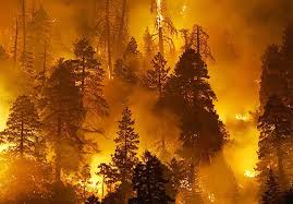 Wild land fires most commonly occur in semi arid and temperate regions having abundant vegetation and extensive dry periods. Fire is a potential hazard whenever vegetation desiccates. This often occurs as the result of drought. Fires occur less frequently in colder and wetter climates, Winds can increase a fire’s intensity while providing few escape routes. Lightning is a most common cause of wildfire during the growing season. Dry weather prior to thunderstorms during spring, summer, or fall increases the risk of a fire from lightning.
Reducing the Impact of Natural Hazards
There are information and techniques designed to minimize the effects of even the most sudden and forceful of hazardous events and prevent than causing a disaster. But in some instances the situation itself cannot be avoided, construction measures and location decisions can help save lives and avoid damage. In some instances, such as flooding, the integration of hazard mitigation measures into development planning and investment projects may make it possible to avoid the hazards entirely.
Mitigation measure is better seen as a fundamental investment, essential to all development projects in high-risk areas, and not as a luxury that may not be affordable. The vulnerability of many places around the world to hurricanes, earthquakes, volcanic eruptions, flooding, or drought is widely recognized.
Environmental planners should not ask the question whether these events will happen, but what may occur when they do. The normal single-sector planning technique can no longer maximize the benefits of mitigation methods and may, in fact, increase the risk exposure of people and their property. Since the orthodox development project often represents an isolated intervention into complex and long- standing natural and socioeconomic processes, an advance in one area may not be accompanied by needed change in another. When natural events subsequently exert pressure, the fruits of the project may be lost to a disaster cause d by the deterioration of the natural and human environment related, in turn, to the project itself (Hogan & Marandola, 2007).
Environmentally integrated development planning, relatively implies, a multicultural approach. It accounts both for a change in associated sectors that share a defined physical space and for the changing relationships between sectors as the result of an intervention. Underlying the integrated approach is the assumption that change is organic and that an initiative in one sector affects the region as a whole.

